Category: North Canyon Naturalist

Where Do You Find Steelhead in the Pacific Ocean?

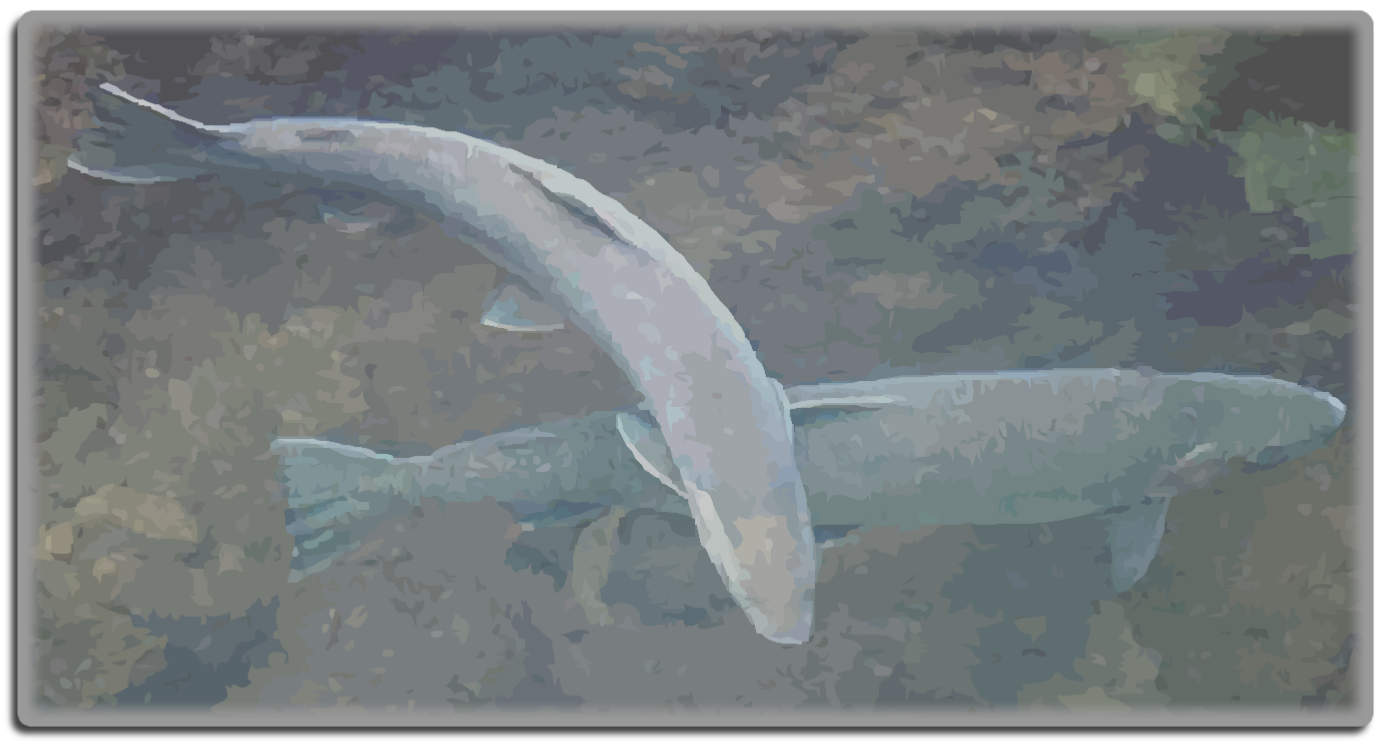
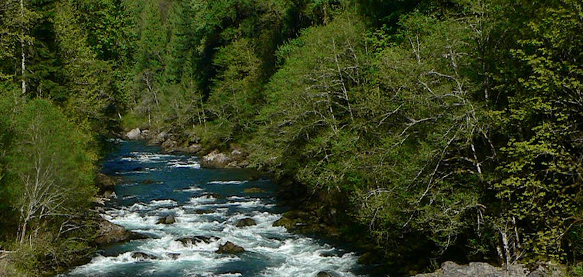
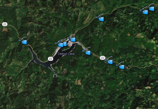
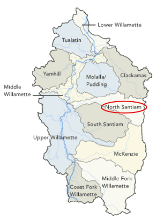
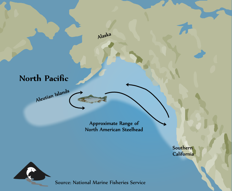
Young winter steelhead fry, freshly hatched in the cold waters of the the North Santiam River, face a long and harrowing journey that takes them to the sea and back. In spring through early summer of their second year, steelhead smolts from the North Santiam River enter the sea and move directly offshore. Beyond that,…
Read more

Winter Steelhead of the North Santiam River

As winter gives way to the cold rains of spring in the North Santiam Canyon, newly hatched steelhead fry begin to wriggle their way to the surface of their gravel nest. In the cold waters of a tributary stream above the North Santiam River, their stream, they face a long and harrowing journey that will…
Read more

North Santiam River Report January 1, 2013

The North Santiam River level is dropping and the water is cold. Clarity is tolerable. Some new steelhead are coming upstream, and we now have 412 fresh steelhead in the river system plus quite a few left over summer steelhead, some of which are still good and some of which should be returned to the…
Read more

Indian Pipe

Indian Pipe is a Parasitic Plant of Trees and Fungus

On a recent hike along Pamilia Creek, I came across this clump of Indian Pipe growing under a dense stand of large Douglas fir.  It caught my eye, because even though it’s a herbaceous plant, it looks more like a fungus. In fact, I always assumed Indian Pipe, like many fungi, lived off of the…
Read more

North Santian River Report

North Santiam River Report, October 1, 2012

[box type=”alert” size=”large” style=”rounded”]The boat ramp at Shelburn is a little difficult to pull into from upstream because of two large branches sticking out in the waves just above the ramp. It is possible to see the branches from upstream and to row around them, toward the middle of the river, and then to cut…
Read more

Devil's Club

Devil’s Club Decorates Old Growth Forests in Late Summer

Devil’s club or devil’s walking stick is a large shrub native to the cool moist conifer forests.  It is found from  Alaska to western Oregon and eastward to western Alberta and Montana. This native shrub always catches my eye in the late summer.  Those clusters of showy red berries remind me of Christmas.   I’ve…
Read more

North Santian River Report

North Santiam River Report for September 12, 2012

Watching salmon spawn is not necessarily voyeurism. Scientifically, it is an interesting process and if we understand it we are able to help the salmon be more successful with their reproduction and also to be more successful with our fishing techniques. Some of the salmon started spawning the last week of August and the first…
Read more

North Santian River Report

Fishing Conditions on the North Santiam, August 23, 2012

River flows volumes are excellent right now , currently around 1,160 cfs at Mehama on the North Fork with good visibility.  Conditions are expected to stay at these levels for the next week.  Most of the salmon and steelhead have moved into the upper river.  Based on video monitoring at Bennett dam near Stayton, approximately…
Read more

North Santiam River at Niagara

North Santiam River Report August 13, 2012

The weather has been great, and is likely to continue. Water temperature is in the mid-fifties both going into and coming out of Detroit Lake. Niagara water has been between 56 and 59 degrees, tolerable for steelhead and salmon. Water temperature at Green’s Bridge has been between 64 and 71, much too warm for sporting…
Read more

Find out where hatchery trout are released in the North Santiam Watershed

The Oregon Department of Fish and Wildlife stocks hatchery reared trout at many locations in the North Santiam Canyon. Click on any of the fish icons shown on the following map to learn a little more about the locations that receive hatchery trout. View ODFW trout stocking sites in a larger map

North Santiam River at Niagara

Quick Facts About the North Santiam River

The waters of the North Santiam begin their journey on the snowy slopes of Mount Jefferson. Nearly ninety miles later they join the South Santiam. Along its journey the river flows past forest and farm, field and city. Its flow is interrupted by high wall dams and and diverted for irrigation, municipal use and even…
Read more

Watersheds of the Willamette River Basin

What is a watershed?

When we talk about a watershed on these pages, we’re referring to the land area drained by a river or stream. So a “watershed” can be the huge land area drained by the Columbia River or the area drained by the Willamette River.  A watershed can be the 766 square miles drained by the North…
Read more