Valentine Creek is a tributary of the North Santiam river, entering the mainstem just below the Geren Island Water Treatment Facility and above the City of Stayton.
The North Santiam Watershed Council has selected Valentine Creek as a priority sub-basin for restoration and enhancement. Valentine Creek is an important tributary of the North Santiam River, entering the mainstem just above the town of Stayton and just below the Upper Bennett Dam and the Geren Island Water Treatment Facility. Approximately 22 square miles of land, primarily agricultural and rural residential, make up the land area that drains into Valentine Creek.
In 2009, Valentine Creek was selected to be a part of the Willamette Model Watershed Program, a regional program designed to improve watershed health. Since 2009, four landowners have partnered with the Council to restore approximately 19 acres of native vegetation on Valentine Creek. Restoration in Valentine Creek has included clearing of invasive species, planting of native trees and shrubs, and a robust maintenance system to ensure that plants can be “free to grow.” Through continued maintenance, the Council hopes to create a mature riparian buffer of native trees and shrubs that can provide shade and habitat for fish and wildlife habitat. Root systems of native plant species also provide some stability to streambanks and filter water entering the system through the subsurface.
Restoration and conservation efforts along the Valentine Creek tributary to the North Santiam River are part of a larger regional initiative to improve water quality. Restoration efforts in Valentine Creek are ongoing. The North Santiam Watershed Councils hopes to continue to partner with landowners in the Valentine Creek watershed on restoration projects.
Watershed Quick Facts
Size of land area that drains into Valentine Creek – 21.8 square miles
Length of Valentine Creek – 5.3 miles
Elevation range in Valentine Creek – 479-2562ft
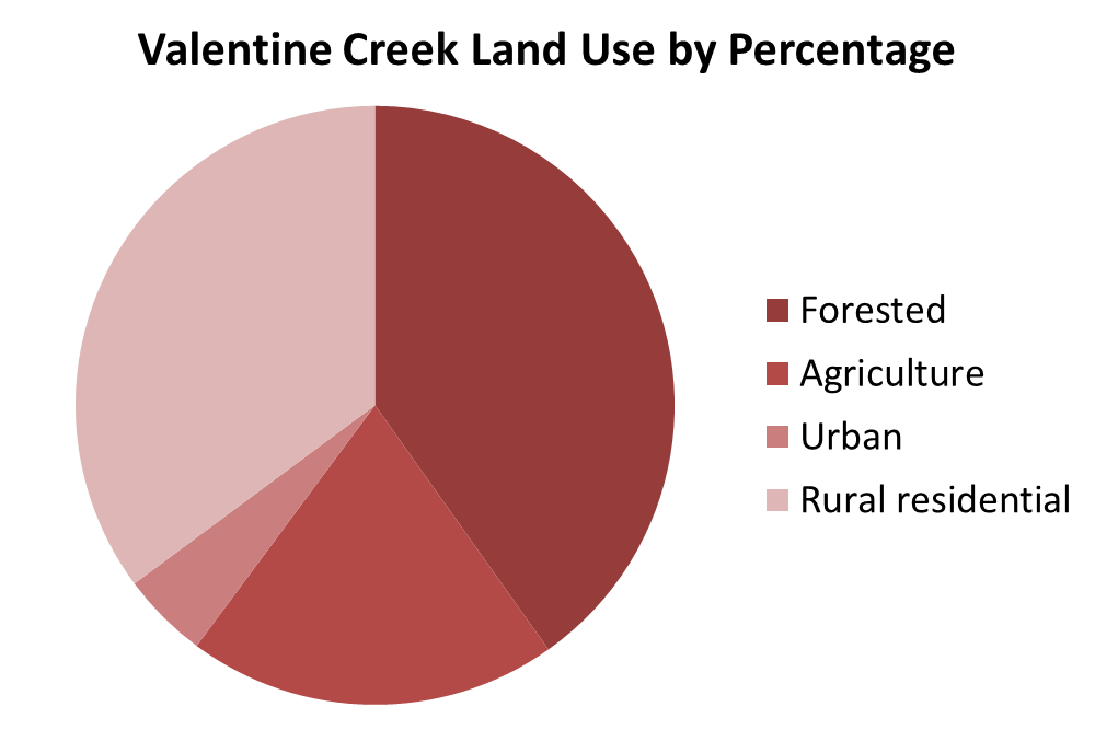
Land use in the Valentine Creek watershed – The land use in this sub-watershed is primarily dominated y forested and rural residential land uses
Habitat Valentine Creek provides – Valentine Creek has 1.9 miles of potential rearing/migration habitat for spring Chinook and 1.2 miles of potential rearing/migration habitat for winter steelhead.