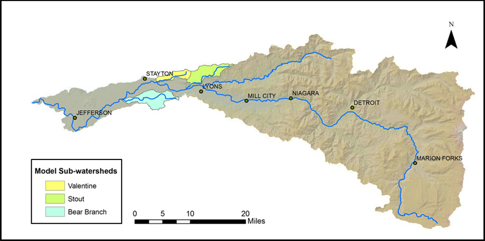
The North Santiam, South Santiam, and Calapooia Watershed Councils collaborate regionally to form the Santiam-Calapooia Model Watershed Collaboration.
The goal of restoration and ecological monitoring through the Model Watershed Program is to move forward a vision of clean healthy waters with ecological flows, native species recovery and diverse floodplain connectivity and healthy riparian forests.
This can be accomplished in tandem with stable economies and working landscapes that support local populations, and communities that sustain those natural resources.
In the North Santiam Watershed, Stout Creek, Valentine Creek, and Bear Branch Creek are part of the Model Watershed Program. All three watersheds are located in the upper extent of the Lower North Santiam Watershed, which drains approximately 113 square miles of land. It is the most heavily populated portion of the watershed, containing the communities of Jefferson, Marion, Stayton, and Lyons. Geren Island, the drinking water facility for the City of Salem, is also located in this portion of the watershed. Thus, water quality in each of these sub-basins impacts the water quality of the North Santiam River. In addition, all three tributaries are listed as essential salmonid habitat and exceed summer temperature standards.
For all of these reasons, these tributaries were prioritized for the Model Watershed Program.
The Council hopes to use lessons learned and tools developed through restoration and monitoring in these sub-watersheds to expand efforts to improve overall watershed health to the entire North Santiam River Basin.
To learn more about restoration work in the North Santiam Model Watersheds, please see the links below:

